
Slika:India-Pakistan Borderlands at Night.JPG
Velikost tega predogleda: 800 × 532 točk. Druge ločljivosti: 320 × 213 točk | 640 × 426 točk | 1.024 × 681 točk | 1.280 × 852 točk | 2.560 × 1.703 točk | 4.256 × 2.832 točk.
Izvorna datoteka (4.256 × 2.832 točk, velikost datoteke: 3,11 MB, MIME-vrsta: image/jpeg)
Spodaj prikazane informacije so s tamkajšnje opisne strani.
Povzetek
| Opis |
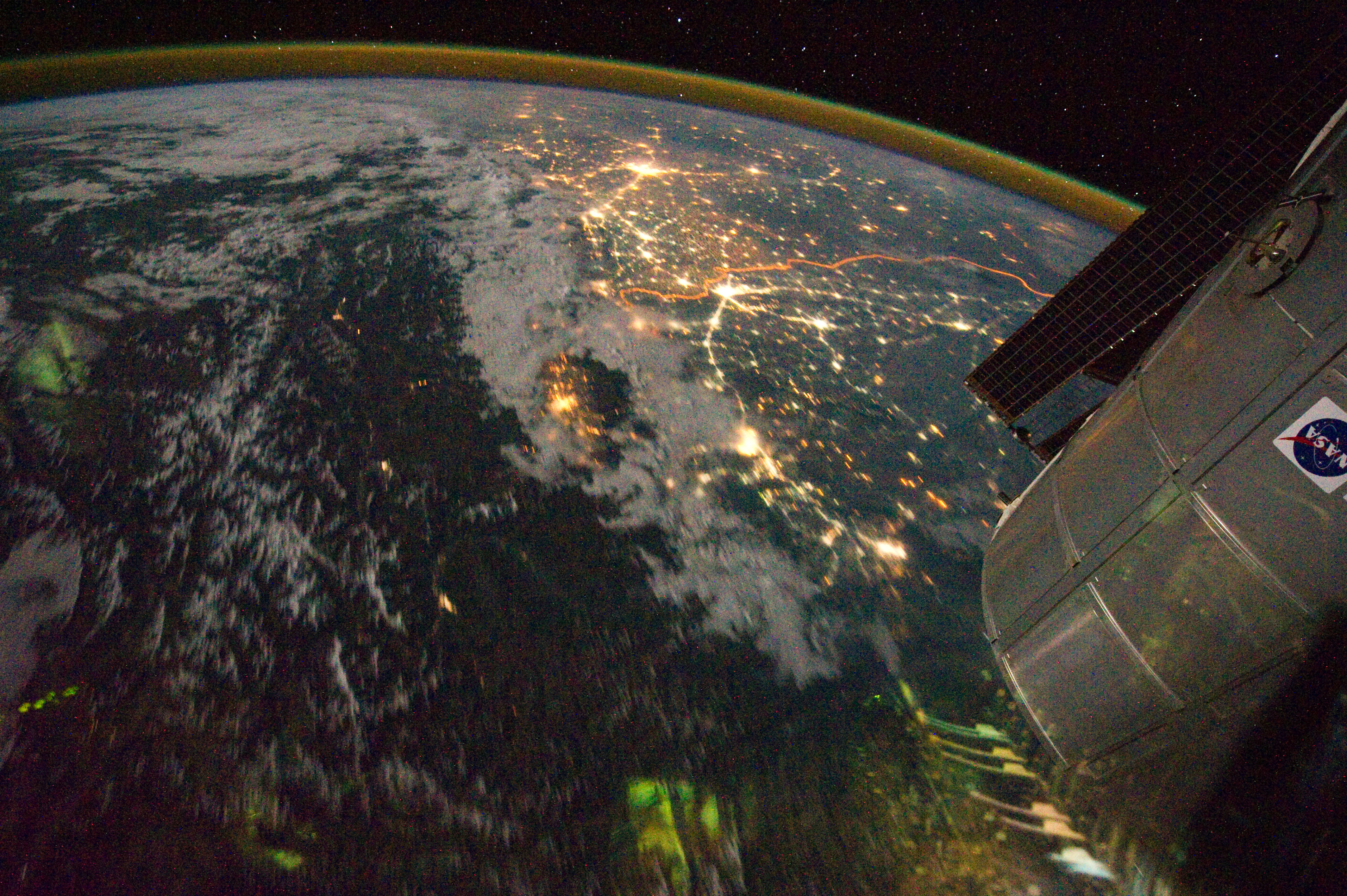
English: Clusters of yellow lights on the Indo-Gangetic Plain reveal numerous cities large and small in this astronaut photograph of northern India and northern Pakistan.
|
| Datum | |
| Vir | NASA Earth Observatory |
| Avtor | ISS Expedition 28 crew |
| Lokacija fotoaparata | | Ta in druge slike po lokaciji: OpenStreetMap |
|---|
To sliko ali ta video je katalogiziral Johnson Space Center Nacionalne uprave za aeronavtiko in vesolje (NASA) Združenih držav Amerike pod oznako fotografije: ISS028-E-29679. Ta predloga ne označuje avtorskopravnega stanja dela. Ob njej mora stati tudi običajna oznaka avtorskopravnega stanja gradiva. Glejte Commons:Navedba licence. Drugi jeziki:
|
Image acquired with a Nikon D3S digital camera using a 16 mm lens, and is provided by the ISS Crew Earth Observations experiment and Image Science & Analysis Laboratory, Johnson Space Center.
Licenca
| Ta datoteka je v javni domeni, ker jo je izdelala izključno NASA. Avtorskopravna politika NASE pravi, da »Gradivo NASE ni zaščiteno z avtorskimi pravicami, razen če je rečeno drugače.« (glej Template:PD-USGov, stran z avtorskopravno politiko NASE ali Politiko uporabe slik JPL.) | ||
 |
Opozorila:
|
| Annotations | This image is annotated: View the annotations at Commons |
Zgodovina datoteke
Kliknite datum in čas za ogled datoteke, ki je bila takrat naložena.
| Datum in čas | Sličica | Velikost | Uporabnik | Komentar | |
|---|---|---|---|---|---|
| trenutno | 17:03, 6. september 2011 | | 4.256 × 2.832 (3,11 MB) | Originalwana | {{Information |Description ={{en|1=Clusters of yellow lights on the Indo-Gangetic Plain reveal numerous cities large and small in this astronaut photograph of northern India and northern Pakistan. Of the hundreds of clusters, t |
Uporaba datoteke
Datoteka je del naslednje 1 strani slovenske Wikipedije (strani drugih projektov niso navedene):
Globalna uporaba datoteke
To datoteko uporabljajo tudi naslednji vikiji:
- Uporaba na ar.wikipedia.org
- Uporaba na bh.wikipedia.org
- Uporaba na bn.wikipedia.org
- Uporaba na ca.wikipedia.org
- Uporaba na en.wikipedia.org
- Uporaba na hi.wikipedia.org
- Uporaba na sr.wikipedia.org
- Uporaba na ta.wikipedia.org
- Uporaba na te.wikipedia.org
- Uporaba na uk.wikipedia.org
- Uporaba na vi.wikipedia.org