
Slika:Tectonic plates hotspots-en.svg

Velikost tega predogleda PNG datoteke SVG: 800 × 547 točk. Druge ločljivosti: 320 × 219 točk | 640 × 437 točk | 1.024 × 700 točk | 1.280 × 874 točk | 2.560 × 1.749 točk | 1.092 × 746 točk.
Izvorna datoteka (Datoteka SVG, nominalno 1.092 × 746 pikslov, velikost datoteke: 898 KB)
Spodaj prikazane informacije so s tamkajšnje opisne strani.
Povzetek
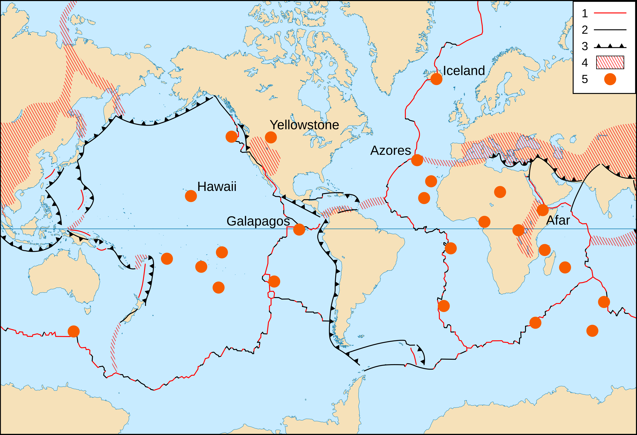
- Key :
- 1 : Divergent plate boundaries ;
- 2 : Transform plate boundaries ;
- 3 : Convergent plate boundaries ;
- 4 : Plate boundary zones ;
- 5 : Selected prominent hotspots.
| Opis |
English: World map in English of selected prominent geological hotspots.
Français : Carte en anglais des principaux points chauds géologiques mondiaux. |
| Datum | 2006-10, upgraded 2015-09 |
| Vir |
|
| Avtor | Eric Gaba (Sting - fr:Sting) |
| Dovoljenje (Nadaljnja uporaba datoteke) |
Public domain |
| Druge različice |
Izpeljana dela te datoteke:
|


Licenca
This image is in the public domain in the United States because it only contains materials that originally came from the United States Geological Survey, an agency of the United States Department of the Interior. For more information, see the official USGS copyright policy.
|
| This work was previously under Public Domain, or a Free License. It has been digitally enhanced and/or modified. This derivative work has been (or is hereby) released into the public domain by its author, Sting at the French Wikipedia project. This applies worldwide. In some countries this is not legally possible; if so:
|
Zgodovina datoteke
Kliknite datum in čas za ogled datoteke, ki je bila takrat naložena.
| Datum in čas | Sličica | Velikost | Uporabnik | Komentar | |
|---|---|---|---|---|---|
| trenutno | 23:17, 6. september 2015 | | 1.092 × 746 (898 KB) | Sting | Upgraded background map using NGDC WCL data |
| 23:38, 2. junij 2008 |  | 1.100 × 750 (373 KB) | Sting | Display bug correction | |
| 10:58, 2. marec 2008 |  | 1.100 × 750 (182 KB) | QWerk | Cleaned code. Lets see does it work now. | |
| 01:25, 22. oktober 2006 | Brez predogleda | (397 KB) | Sting | * '''Key :''' :'''1 :''' Divergent plate boundaries ; :'''2 :''' Convergent plate boundaries ; :'''3 :''' Transform plate boundaries ; :'''4 :''' Plate boundary zones ; :'''5 :''' Selected prominent hotspots. {{Information |Description=World map in Engl |
Uporaba datoteke
Datoteka je del naslednje 1 strani slovenske Wikipedije (strani drugih projektov niso navedene):
Globalna uporaba datoteke
To datoteko uporabljajo tudi naslednji vikiji:
- Uporaba na ar.wikipedia.org
- Uporaba na ca.wikipedia.org
- Uporaba na cs.wikipedia.org
- Uporaba na de.wikipedia.org
- Uporaba na es.wikipedia.org
- Uporaba na ja.wikipedia.org
- Uporaba na no.wikipedia.org
- Uporaba na pt.wikipedia.org
- Uporaba na simple.wikipedia.org