
Slika:Kingdom of France 1000.svg

Velikost tega predogleda PNG datoteke SVG: 485 × 340 točk. Druge ločljivosti: 320 × 224 točk | 640 × 449 točk | 1.024 × 718 točk | 1.280 × 897 točk | 2.560 × 1.795 točk.
Izvorna datoteka (Datoteka SVG, nominalno 485 × 340 pikslov, velikost datoteke: 1,22 MB)
Spodaj prikazane informacije so s tamkajšnje opisne strani.
Povzetek
Ta W3C-nedoločena vektorska slika je bila ustvarjena z Inkscape .


.svg)
.svg)
.svg)
.svg)
.svg)


.svg)
.svg)
.svg)


.png)
.png)


.svg)


.svg)

.svg)


.svg)
.svg)
.svg)
.svg)


.svg)
.png)


.svg)


.svg)
.svg)


.svg)


.svg)


.svg)
.svg)
.svg)
.svg)
.svg)
.svg)
.svg)
.svg)
_cropped.svg)
.svg)
.svg)
.svg)
.svg)
.svg)
.svg)
.svg)
.svg)
.svg)
.svg)
.svg)
.svg)
.svg)
.svg)
.svg)
.svg)
.svg)
.svg)
.svg)
.svg)
.svg)
.svg)
.svg)
.svg)
.svg)
.svg)
.svg)
.svg)
.svg)
.svg)
.svg)
.svg)
.svg)
.svg)
.svg)
.svg)
.svg)
.svg)
.svg)
.svg)
.svg)
.svg)
.svg)
.svg)
.svg)
Licenca
Datoteka je objavljena pod licenco Creative Commons Priznanje avtorstva-Deljenje pod enakimi pogoji 4.0 Mednarodno.
- Dovoljeno vam je:
- deljenje – reproducirati, distribuirati in javno priobčevati delo
- predelava – predelati delo
- Pod naslednjimi pogoji:
- priznanje avtorstva – Navesti morate ustrezno avtorstvo, povezavo do licence in morebitne spremembe. To lahko storite na kakršen koli primeren način, vendar ne na način, ki bi nakazoval, da dajalec licence podpira vas ali vašo uporabo dela.
- deljenje pod enakimi pogoji – Če boste to vsebino predelali, preoblikovali ali uporabili kot izhodišče za drugo delo, morate svoj prispevek distribuirati pod enako ali združljivo licenco, kot jo ima izvirnik.
Zgodovina datoteke
Kliknite datum in čas za ogled datoteke, ki je bila takrat naložena.
| Datum in čas | Sličica | Velikost | Uporabnik | Komentar | |
|---|---|---|---|---|---|
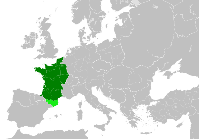
| trenutno | 00:55, 20. julij 2023 | | 485 × 340 (1,22 MB) | Wario2 | The counties of Barcelona and Aragon were autonomous (de facto independent) and not an integral part of the realm) |
| 18:22, 23. maj 2016 |  | 485 × 340 (1,25 MB) | Alphathon | Corrected Flanders and incorporated some islands into their respective counties/duchies | |
| 16:41, 23. maj 2016 |  | 485 × 340 (1,25 MB) | Alphathon | Corrected status of Bohemia | |
| 20:13, 22. maj 2016 |  | 485 × 340 (1,23 MB) | Alphathon | Split Capua from Benevento and removed both from HRE, along with Spoleto | |
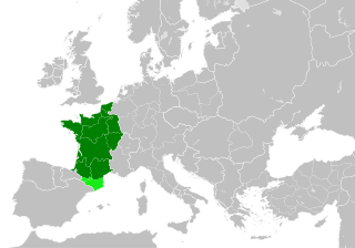
| 18:46, 22. maj 2016 |  | 485 × 340 (1,24 MB) | Alphathon | == {{int:filedesc}} == {{Inkscape}} {{Information |Description={{en|A map of the en:Kingdom of France within Europe circa 1000 CE. The main subdivisions of the Byzantine Empire, Holy Roman Empire, Burgundy, France and Poland are also shown.}} |So... |
Uporaba datoteke
Datoteka je del naslednje 1 strani slovenske Wikipedije (strani drugih projektov niso navedene):
Globalna uporaba datoteke
To datoteko uporabljajo tudi naslednji vikiji:
- Uporaba na arz.wikipedia.org
- Uporaba na cs.wikipedia.org
- Uporaba na da.wikipedia.org
- Uporaba na en.wikipedia.org
- Uporaba na es.wikipedia.org
- Uporaba na fa.wikipedia.org
- Uporaba na he.wikipedia.org
- Uporaba na it.wikipedia.org
- Uporaba na ko.wikipedia.org
- Uporaba na mn.wikipedia.org
- Uporaba na nrm.wikipedia.org
- Uporaba na simple.wikipedia.org
- Uporaba na th.wikipedia.org
- Uporaba na tr.wikipedia.org
- Uporaba na uk.wikipedia.org
- Uporaba na ur.wikipedia.org
- Uporaba na vi.wikipedia.org
- Uporaba na www.wikidata.org
- Uporaba na zh.wikipedia.org
.svg)