
Slika:Himalayan Tectonic Summary.png
Velikost tega predogleda: 800 × 519 točk. Druge ločljivosti: 320 × 207 točk | 640 × 415 točk | 1.024 × 664 točk | 1.280 × 830 točk | 2.658 × 1.723 točk.
Izvorna datoteka (2.658 × 1.723 točk, velikost datoteke: 729 KB, MIME-vrsta: image/png)
Spodaj prikazane informacije so s tamkajšnje opisne strani.
Povzetek
| Opis |
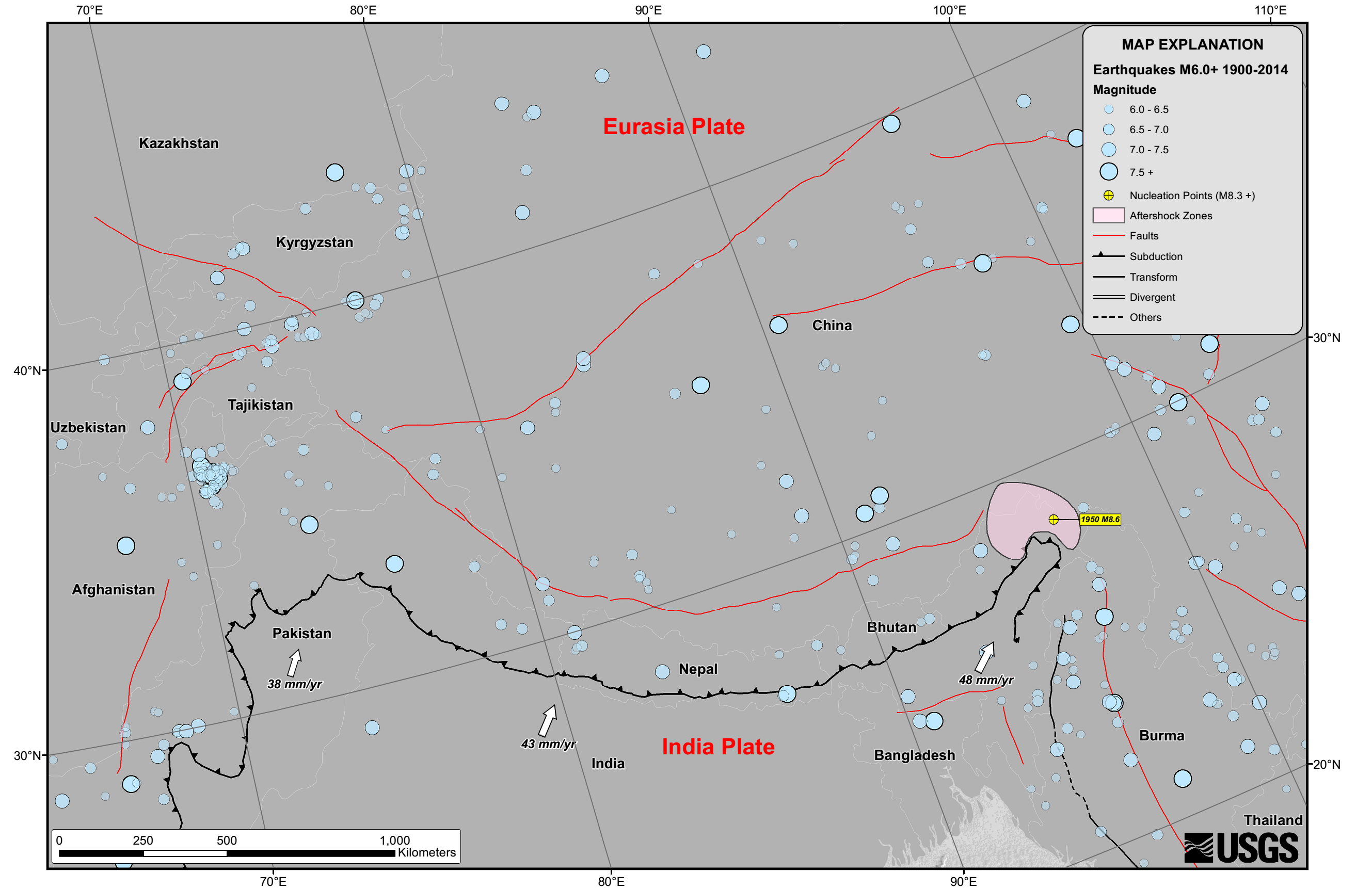
English: Seismicity in the Himalaya dominantly results from the continental collision of the India and Eurasia plates, which are converging at a relative rate of 40-50 mm/yr. Northward underthrusting of India beneath Eurasia generates numerous earthquakes and consequently makes this area one of the most seismically hazardous regions on Earth. The surface expression of the plate boundary is marked by the foothills of the north-south trending Sulaiman Range in the west, the Indo-Burmese Arc in the east and the east-west trending Himalaya Front in the north of India. |
| Datum | |
| Vir | https://earthquake.usgs.gov/earthquakes/tectonic/images/himalaya_tsum.pdf |
| Avtor | United States Geological Survey |
Licenca
This image is in the public domain in the United States because it only contains materials that originally came from the United States Geological Survey, an agency of the United States Department of the Interior. For more information, see the official USGS copyright policy.
|
Zgodovina datoteke
Kliknite datum in čas za ogled datoteke, ki je bila takrat naložena.
| Datum in čas | Sličica | Velikost | Uporabnik | Komentar | |
|---|---|---|---|---|---|
| trenutno | 12:53, 26. april 2015 | | 2.658 × 1.723 (729 KB) | Tatiraju.rishabh | User created page with UploadWizard |
Uporaba datoteke
Datoteka je del naslednje 1 strani slovenske Wikipedije (strani drugih projektov niso navedene):
Globalna uporaba datoteke
To datoteko uporabljajo tudi naslednji vikiji:
- Uporaba na af.wikipedia.org
- Uporaba na ar.wikipedia.org
- Uporaba na awa.wikipedia.org
- Uporaba na be.wikipedia.org
- Uporaba na en.wikipedia.org
- Uporaba na es.wikipedia.org
- Uporaba na hi.wikipedia.org
- Uporaba na nl.wikipedia.org
- Uporaba na pnb.wikipedia.org
- Uporaba na ru.wikipedia.org
- Uporaba na ta.wikipedia.org
- Uporaba na tg.wikipedia.org
- Uporaba na ur.wikipedia.org
- Uporaba na zh.wikipedia.org