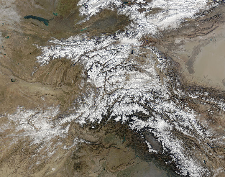
Slika:Hindu Kush satellite image.jpg

Velikost tega predogleda: 763 × 600 točk. Druge ločljivosti: 306 × 240 točk | 611 × 480 točk | 978 × 768 točk | 1.280 × 1.006 točk | 2.560 × 2.011 točk | 5.600 × 4.400 točk.
Izvorna datoteka (5.600 × 4.400 točk, velikost datoteke: 5,01 MB, MIME-vrsta: image/jpeg)
Zgodovina datoteke
Kliknite datum in čas za ogled datoteke, ki je bila takrat naložena.
| Datum in čas | Sličica | Velikost | Uporabnik | Komentar | |
|---|---|---|---|---|---|
| trenutno | 06:39, 6. junij 2006 |  | 5.600 × 4.400 (5,01 MB) | Avenue | {{Information |Description=The Hindu Kush occupies the lower-left-center of this true-color MODIS satellite image, acquired 28 November 2003. |Source=[NASA's Earth Observatory http://earthobservatory.nasa.gov/Newsroom/NewImages/images.php3?img_id=16411] | |
Uporaba datoteke
Datoteka je del naslednje 1 strani slovenske Wikipedije (strani drugih projektov niso navedene):
Globalna uporaba datoteke
To datoteko uporabljajo tudi naslednji vikiji:
- Uporaba na bcl.wikipedia.org
- Uporaba na bn.wikipedia.org
- Uporaba na ca.wikipedia.org
- Uporaba na el.wikipedia.org
- Uporaba na en.wikipedia.org
- Uporaba na es.wikipedia.org
- Uporaba na et.wikipedia.org
- Uporaba na eu.wikipedia.org
- Uporaba na fa.wikipedia.org
- Uporaba na fi.wikipedia.org
- Uporaba na it.wikipedia.org
- Uporaba na mk.wikipedia.org
- Uporaba na ml.wikipedia.org
- Uporaba na mr.wikipedia.org
- Uporaba na nl.wikipedia.org
- Uporaba na nn.wikipedia.org
- Uporaba na pa.wikipedia.org
- Uporaba na pl.wikipedia.org
- Uporaba na pnb.wikipedia.org
- Uporaba na pt.wikipedia.org
- Uporaba na ro.wikipedia.org
- Uporaba na sk.wikipedia.org
- Uporaba na sr.wikipedia.org
- Uporaba na ta.wikipedia.org
- Uporaba na tg.wikipedia.org
- Uporaba na th.wikipedia.org
- Uporaba na uz.wikipedia.org
- Uporaba na vi.wikipedia.org


